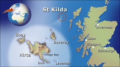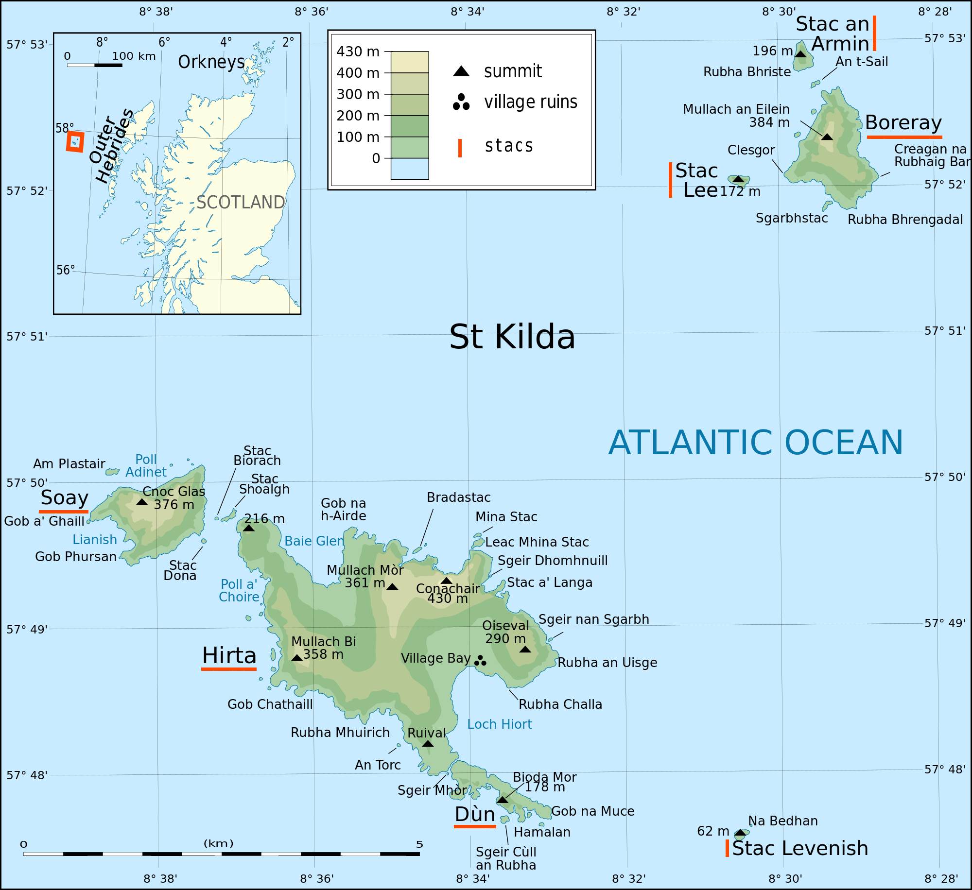
ST KILDA ARCHIPELAGO - OVERVIEW
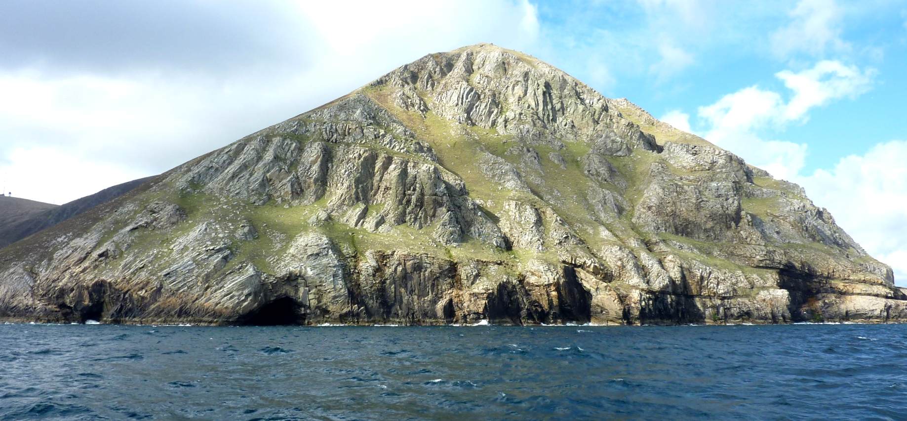
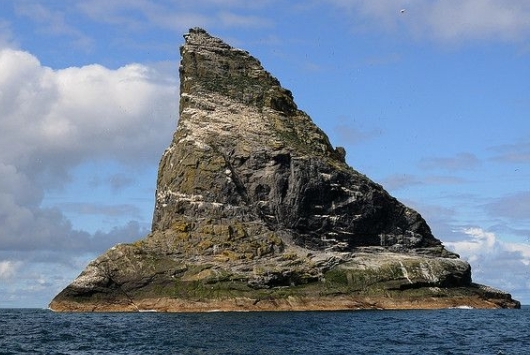
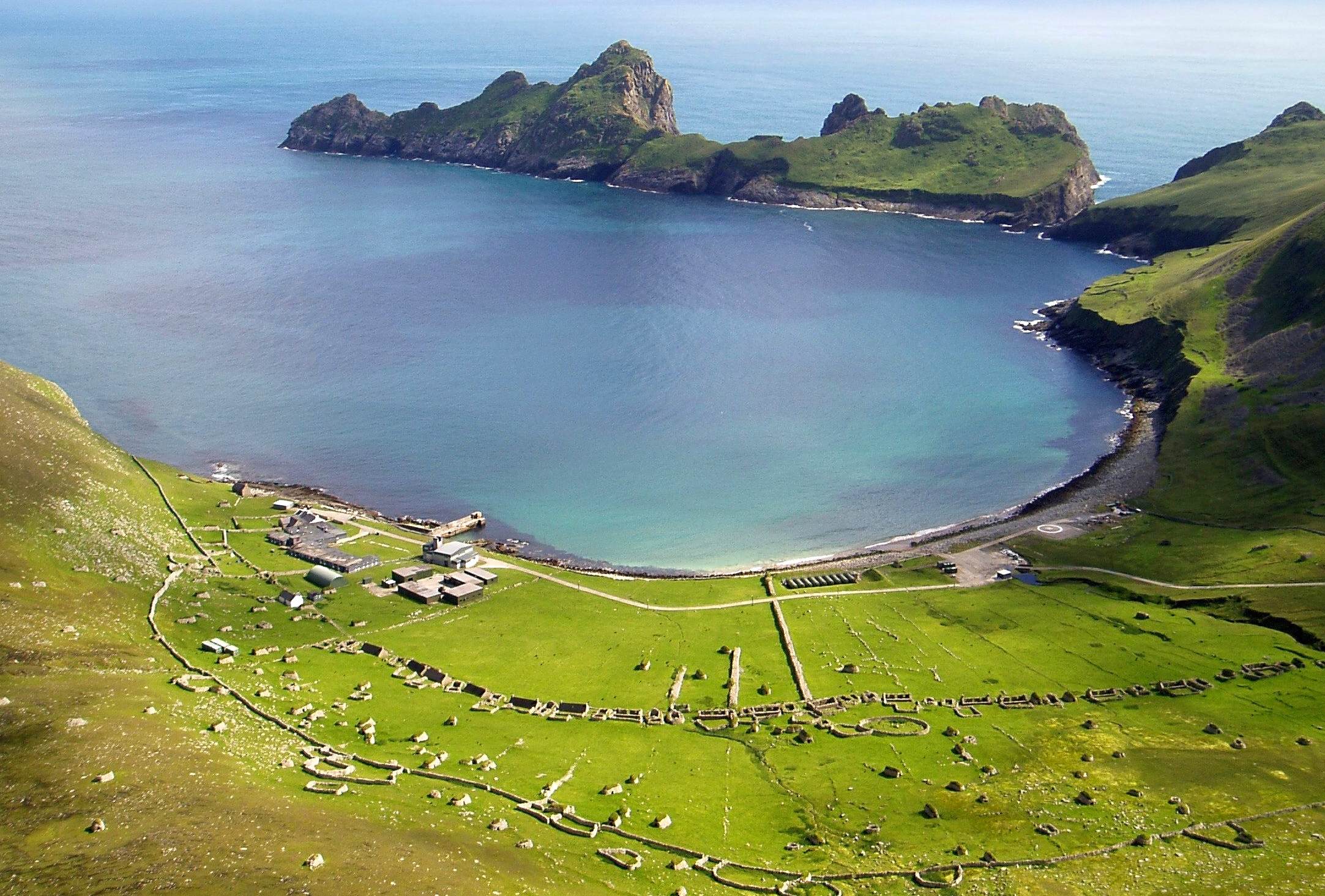
the scottish st kilda islands are an isolated archipelago 64 kilometres west-northwest of north uist in the north atlantic ocean, which belongs to the outer hebrides of scotland. the largest island is hirta, whose sea cliffs are the highest in the united kingdom; the other islands are dun, soay and boreray. furthermore there are many steep rock isles, called stac. the largest mountain on hirta is 430 m high. the weather is predominantly pretty rough.
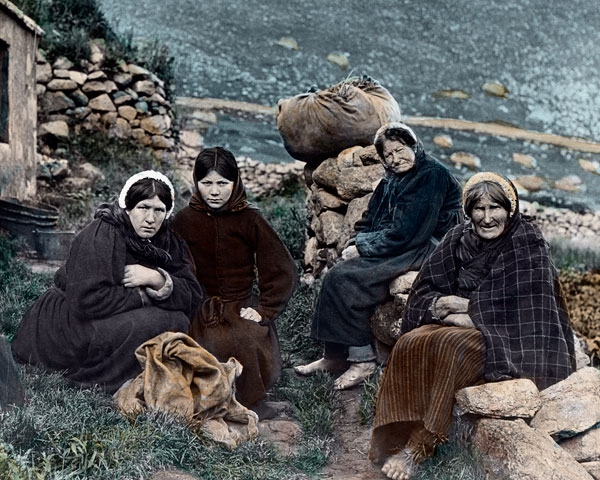
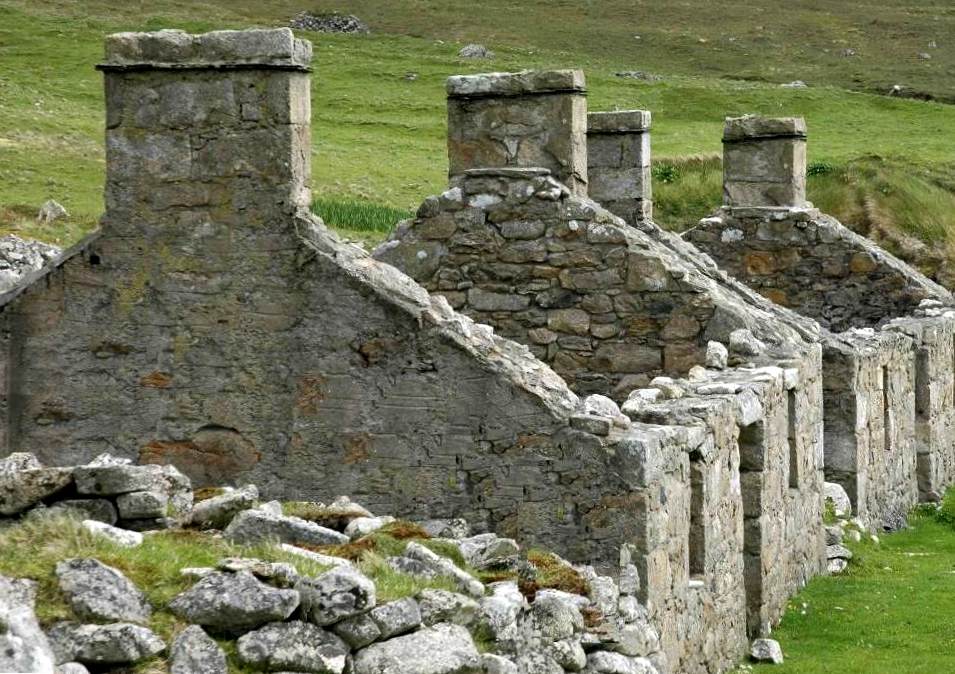
on the east coast of hirta is a bay, loch hiort, used by ships, and settlements were established there. st kilda may have been permanently inhabited for two millennia, from the bronze age to the 20th century, mainly on hirta, yet the population never exceeded 200. the "st" in st kilda actually does not refer to any person of holiness. one interpretation says that it is a distortion of an early norse naming. for a long time the islands were owned by scottish lords, who charged an annual 'rent'.
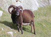
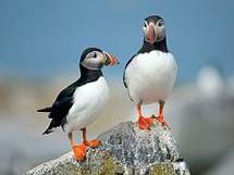
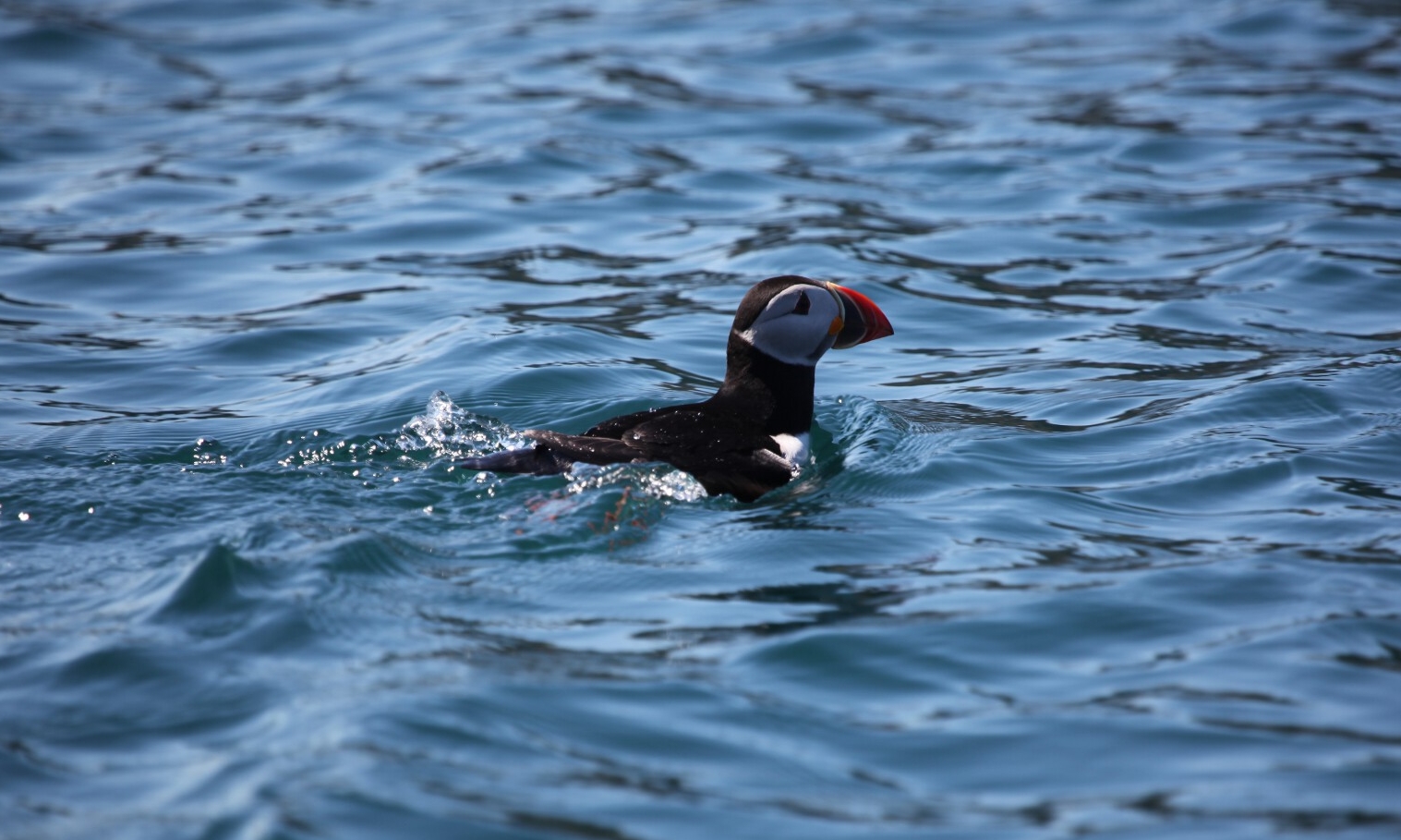
agriculture is barely feasible. regarding the fauna: the islands are a vast breeding ground for many seabird species, including the northern gannets, leach's petrels, fulmars, and the well-known atlantic puffins. also, two different types of sheep have survived on these remote islands. up to 2000 were kept by the st kildans on the islands of hirta and boreray; some are still there.
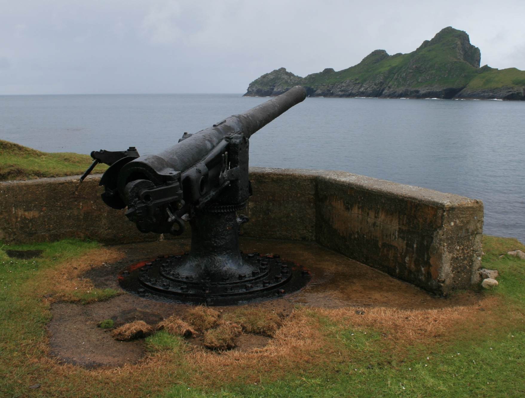
st kilda was never really involved in wars. however, around 1900 the royal navy erected a signal station on hirta, for regular communications with the mainland. in a belated response, the german submarine sm u-90 arrived in village bay on 15 may 1918 and, after issuing a warning, started shelling the island and destroyed the wireless station. as a result of this attack, a large gun was erected at the village bay, but it never faced military use.
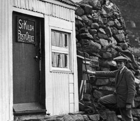
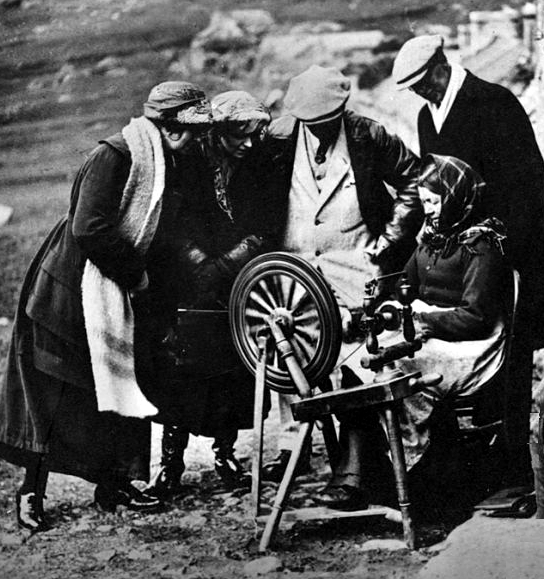
hirta was regularly visited by ships (not in winter though). linked to that, eventually mail correspondence developed; hirta had a tiny post office, and there was even a pertinent stamp issued. later in time the ships brought also tourists, who looked at the local people and their production of clothes. unfortunately they also brought various diseases, which had very harmful impacts. this, plus increasing difficulties to have enough food, and loosing people who left the island, finally was too hard to cope with.
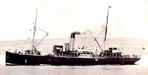
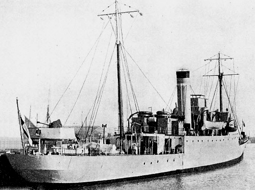
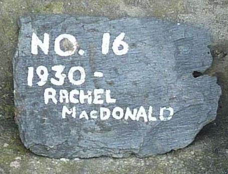
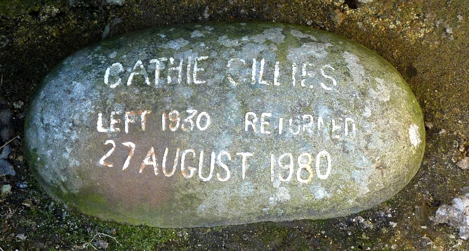
so the end of st kilda came. on 29 august 1930, the entire remaining population of just 36 inhabitants was evacuated - the ship "horwell" brought them to the scottish mainland. all houses stand empty since then, and residents left markers when leaving.
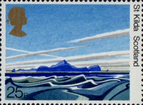
in 1987 st kilda became a world heritage site - an incredible honour for an island where actually no one lives anymore!
on the east coast of hirta is a bay, loch hiort, used by ships, and settlements were established there. st kilda may have been permanently inhabited for two millennia, from the bronze age to the 20th century, mainly on hirta, yet the population never exceeded 200. the "st" in st kilda actually does not refer to any person of holiness. one interpretation says that it is a distortion of an early norse naming. for a long time the islands were owned by scottish lords, who charged an annual 'rent'.
agriculture is barely feasible. regarding the fauna: the islands are a vast breeding ground for many seabird species, including the northern gannets, leach's petrels, fulmars, and the well-known atlantic puffins. also, two different types of sheep have survived on these remote islands. up to 2000 were kept by the st kildans on the islands of hirta and boreray; some are still there.
st kilda was never really involved in wars. however, around 1900 the royal navy erected a signal station on hirta, for regular communications with the mainland. in a belated response, the german submarine sm u-90 arrived in village bay on 15 may 1918 and, after issuing a warning, started shelling the island and destroyed the wireless station. as a result of this attack, a large gun was erected at the village bay, but it never faced military use.
hirta was regularly visited by ships (not in winter though). linked to that, eventually mail correspondence developed; hirta had a tiny post office, and there was even a pertinent stamp issued. later in time the ships brought also tourists, who looked at the local people and their production of clothes. unfortunately they also brought various diseases, which had very harmful impacts. this, plus increasing difficulties to have enough food, and loosing people who left the island, finally was too hard to cope with.
so the end of st kilda came. on 29 august 1930, the entire remaining population of just 36 inhabitants was evacuated - the ship "horwell" brought them to the scottish mainland. all houses stand empty since then, and residents left markers when leaving.
in 1987 st kilda became a world heritage site - an incredible honour for an island where actually no one lives anymore!