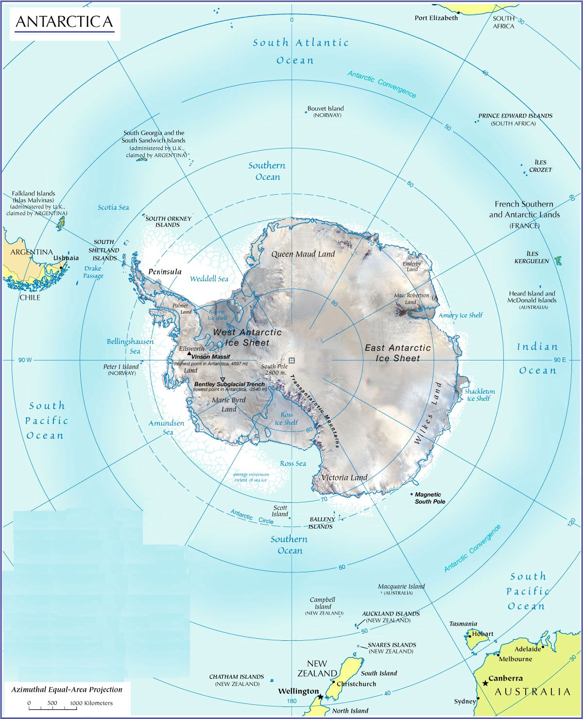
ANTARCTICA: OVERVIEW
antarctica is a huge continent,
thousands of kilometers around the southpole ... it is
almost completely covered with ice, and exposed to
extremely harsh weather - very cold and also very windy …
this made its exploration a truly difficult task … the
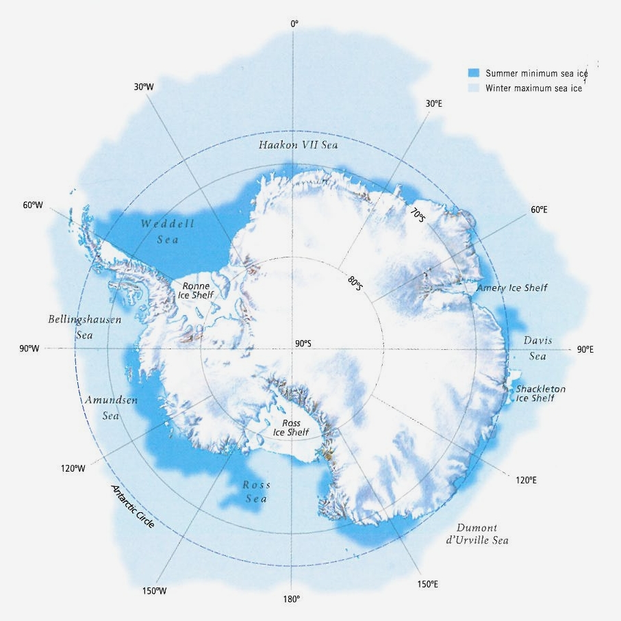
maps below show how hard it is to reach the actual
continent which is surrounded by pack ice even in summer
…
the first folks to stay there for
half a year and to 'over-winter' was the expedition of
borchgrevink (norway) in 1899 … the first explorer to
reach the south pole was amundsen (norway) in 1911 …
antarctica was never settled and there are no towns, yet
over the last hundred years about 30 research stations
have been established, being staffed seasonally (summer)
or year-round …
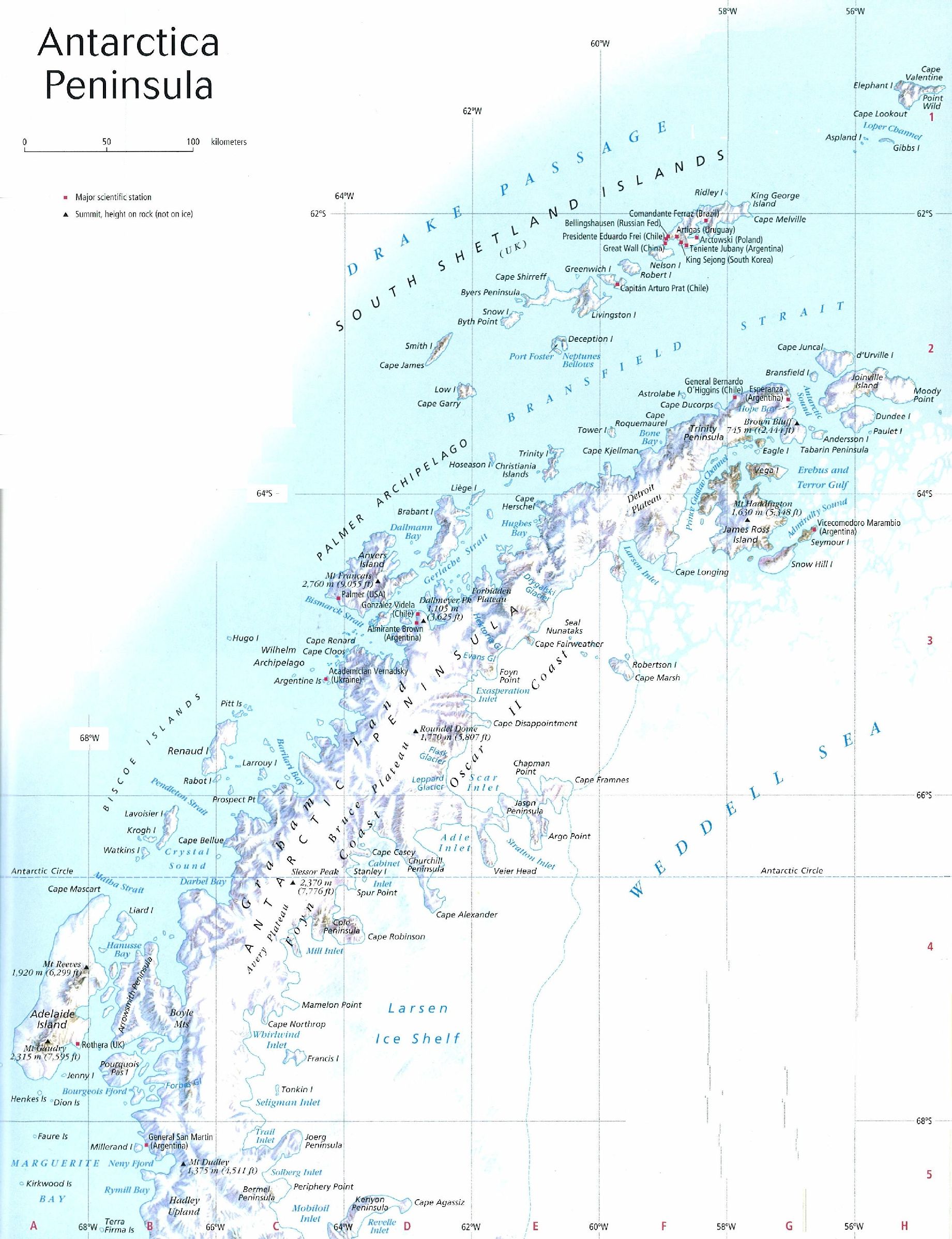
many of them were set up on the
antarctic peninsula (see map above). this peninsula is
easier to reach than other parts of antarctica, from
ushuaia in southern argentina. it is the target of most of
the antarctic cruises. only a few excursions start in new
zealand.
seven picture galleries are prepared, with photos of the incredible landscapes (snow-roofed mountains, glaciers, huge icebergs and ice-covered fjords), photos of the animals living in this rough environment (above all penguins and birds and seals), and photos of exploration endeavours. they result from two excursions, in 2010 and 2013.
note:
there are several "sub-antarctic" islands, including south
georgia (uk), macquarie (australia) and campbell island
(nz); these are (or will be) presented elsewhere.